Disclosure: I may earn affiliate revenue or commissions if you purchase products from links on my website. The prospect of compensation does not influence what I write about or how my posts are structured. The vast majority of articles on my website do not contain any affiliate links.
Continuing my Running at… series, I capped off the fall with a New England road trip. As is typical, I found AllTrails and other online resources to be useless from a runner’s perspective. I know that the audience for such blog posts is minuscule, but I’m happy to provide my unique perspective.
Run 1: https://www.strava.com/activities/4177900172
Run 2: https://www.strava.com/activities/4182350190
Running Cadillac Mountain
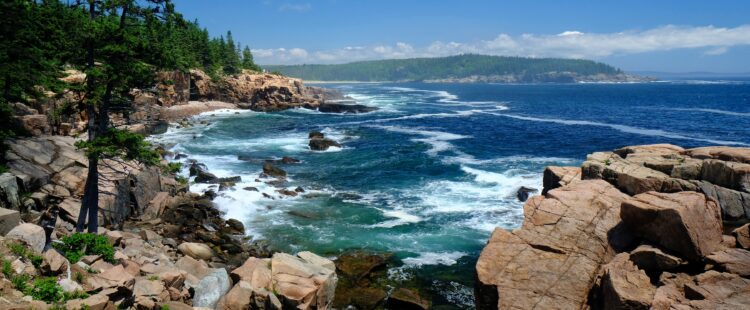
Let’s get right into it. If you want to run (actually run) either up or down Cadillac Mountain, you must use the road. The shoulder is narrow, the road is windy, and the drivers are all distracted. The views during the entire run and summit, however, are breathtaking. So if you’re accepting of the risk of a Chrysler Town & Country taking your breath away first, it’s a viable run. Depending on your angle of approach, the elevation shift is over 1000 feet.
If you’re running it, though, you still have to start somewhere. I recommend parking at the Bubble Pond lot if you’re not linking this run to another loop. This will provide immediate road access for a 3.5-mile journey to the top. Then, you can fly down on the way back.
However, you can also hike up the West Face Trail, which is about a mile. This is how I got to the top and, holy god, it was a scary hike. This isn’t a family-friendly type of thing. This involves actual rock climbing and the roughly one-mile distance took me just under an hour. Once I was at the top, I ran down the road. Again, this was difficult.
Where to Start
Usually, this is the “duh” section of the guide, but not at a national park of this scope. I respect that all runners will be at different fitness levels, and my insane 23+ mile run relays the truth that I exhausted myself trying to do too much.
My initial thought is that it depends on where you’re staying. I had a car, and I decided I would run into the park each day. As you can imagine, the access roads aren’t particularly fun to start or end runs on. Based on the location of my hotel, Duck Brook Road was my closest access point. Note that the road is 100% paved.
Frankly, at a park of this size, the recommendation is that you leave your car at a trailhead that looks interesting and then try out the nearest loop. If you like that loop and you’re in great shape, go one loop deeper. That’s what the type of thing that is possible when trails are expertly built. That’s what I did. For a short run under five miles, you can run the Witch Hole Pond loop at the northern end of the park. The southern end of the park has better scenery, amenities, and hiking trails, but the loops are all significantly longer.
Witch Hole Pond
Beautiful scenery with a short loop of fewer than five miles. There are some elevation changes but the path is all wide “carriage road” which means well-maintained dirt paths. Pedestrian traffic is lesser here, but that doesn’t mean that there is any less to see. Access is somewhat confusing compared to other areas of the park. You need to go up the main access road then turn right onto the second Duck Brook Road exit, then park at the bridge marking the trailhead.
Some elevation changes and great views. You can extend down to Eagle lake, which I did on day 2. This loop alone trumps many of the state parks and state park segments I visited in PA this summer.
Eagle Lake
Wow. Wow wow wow. The path around Eagle Lake spans about six miles and, again, wow, is this a special place. Big Nature. The best 10k you’ll ever run in your life.
Jordan Pond / Bubble Pond
The carriage road extends down to what is basically a runner’s dreamland. Start next to Bubble Pond then extend down, around a mountain that I don’t have the name of, and then up past the Jordan Pond Restaurant(?). You can park at Jordan Pond or Bubble Pond. This loop is over eight miles with an beautiful elevation change on the west side of Jordan Pond. I even saw some bikers exhausted. This is where I ran any remaining speed out of my legs, but I sure did have fun.


