Disclosure: I may earn affiliate revenue or commissions if you purchase products from links on my website.
Promotion: I wrote Framed: A Villain's Perspective on Social Media. It's an outgrowth of everything visitors have liked about this blog since 2016. It's now on sale for $3.99!
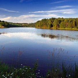
Big Pocono State Park flips the script on the typical Pennsylvania state park trail system. Rather than starting at a base area and running up a mountain, you start at the top of the mountain and hike down, then back up. And the mountain is Camelback Ski Resort! The trails here on the backside aren’t exactly the wide, rolling ski slopes you find during the winter.
This run involves a long steep climb that you will not be able to sustain cadence on if you have a VO2 max under 55. I just made that up but there’s some truth to it, as my VO2 is estimated as 58 and this climb was a major shock to my system.
My run at Big Pocono State Park was 7.03 Miles. You can follow along here.
Where to Start
There are pretty much two choices to make and if neither of them suit you, pick a different state park.
- Don’t park at the top of the mountain but rather start at the mouth of the North Trail Lower Loop near the Pocono Evangelical Free Church (unmarked on DCNR but visible on Strava). Take the gradual uphill around the lower rim that intersects the ski trails then turn around when you feel like it. The path is surprisingly flat after the initial climb (which I didn’t do).
- Park in Lot 3 on Rim road and start on the Vista Trail.
Vista Trail
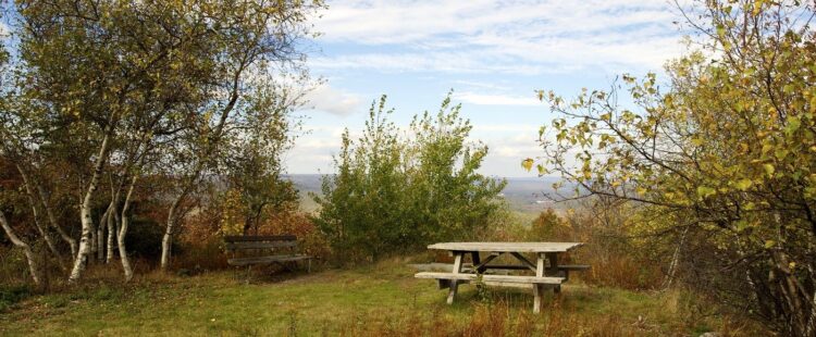
Extremely short trail that connects Rim Road to the South Trail. It does open to a nice vista, but the real point is to get you onto the South Trail.
Sentry(?) Trail
DCNR unlabeled trail connecting Lot 4 to the South Trail. For how short it is, it sure does provide a special view into the forest.
Indian Trail
Do Not Run the Indian Trail
Do Not Run the Indian Trail
Do Not Run the Indian Trail
A brutal and torturous 1.3mi path filled with sharp rocks. It is impossible to run on. At the apex of the path, of course, you can find one of the most beautiful views of the Pocono Mountains. If you must see the view, the north branch is slightly more tolerable, but still pretty awful.
South Trail
A kind of wide, kind of long, kind of loose path that you can use to more gently climb or descend the mountain. Connects to the North Trail and North Trail Lower Loop. The trail is alright but it’s hard to ever really move on.
North Trail Lower Loop
This is what you came for. This path takes you through a canyon filled with mature mountain laurel before opening up as the generic ski resort service road. You can continue running to intersect several ski slopes! The ground here is pretty damp and has quite a few rocks, but is much more smooth than any of the other trails on the mountain.
North Trail
700-foot elevation gain in less than a mile. This is a monster climb that can destroy you. This isn’t the tallest mountain in the world but what makes the rise so brutal is that it feels like something you can accomplish. Take it from me–I’m surprised I didn’t have a heart attack.
Summary
A worthwhile state park for anyone looking to visit a new one. For the runner looking for a challenge, this isn’t worth the drive unless you’re going to attempt the North Trail’s climb. The shortest worthwhile path would be Sentry-South-Lower North-North which would be just slightly over four miles.